Turns out dirt has a lot more to say than we ever imagined. Geologists have been telling us this for eons. Farmers too. Or any kid who likes running toy trucks through the mud brings us to Antonio Guzman. We're not sure if Antonio was one of those kids, but he likes dirt. He's been making his living exploring it for years. His San Jose-based company — Safe2Core — looks under the dirt, grass, concrete, and asphalt to find out what's below before anyone puts a shovel or a backhoe.
Hold that shovel!
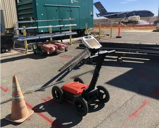
Like any good businessman, Antonio fills a need — in this case, it's ground penetrating radar or GPR. His company uses GPR (and other tools) to scan the earth before a project begins. Most of Safe2Core's work is utility location. GPR scans a specific area to find various utility lines so that when the digging starts for a project, the excavator won't cut through an electrical line or gas line. Guzman purchased a used GSSI GPR system from ObtainSurplus in early October as a backup but put it to work immediately. One of the other units went down, so the fast shipment of the GPR was timely, to say the least.
Unseen and unknown
“We used it at Travis Air Force Base before they started construction near one of the runways,” says Guzman. “There is a good sized area that has a lot of stuff running under the asphalt, so it was a good way to test it out.”

The air base was ready to begin construction, but unsure of what was under the surface, so Safe2Core was brought in, along with its GPR equipment. GPR is basically an antenna that sends energy waves into the ground. A dual-antenna unit, as the one Guzman got from ObtainSurplus, can send high or low-frequency signals.
The highs & lows
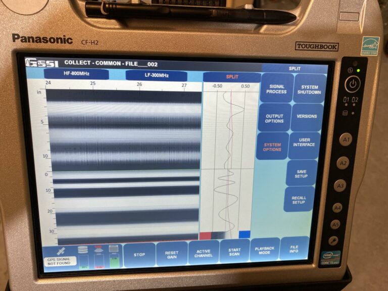
Higher waves are used for shallow penetration and lows for deeper ground. When the waves hit something, they bounce back and are recorded on a computer screen attached to the unit. Wheels measure the distance and speed on the ground. When an operator puts all that together, they can figure out the size and location of the item. The mapping can often get specific about what that item is. A utility line, for example, is pretty easy to identify. A body, not so much.
What or who is beneath?
GPR is credited with the discovery of hundreds of unmarked graves at an old Indian School in Saskatchewan, Canada, in 2021. Without ground-penetrating radar, it would have been extremely difficult to find all the graves. Guzman was not involved in the Canada case but has used GPRs at potential graveyard sites. His company was also called to assist police on a 50-year-old cold case in Los Gatos. Police suspected a body might be found under a concrete slab. Guzman says the GPR did find an indicator, but he wasn't sure if a body was discovered. Like most of the company's projects, they map the area for indicators of underground structures and leave the information with the people who need to dig. The key is knowing the difference between a rock and a metal pipe. The density of both will create blips on the read-out.

It can get a little tricky
“What we see,” cautions Guzman, “is not a photograph, but a readout with lines and waves.”
The line and waves essentially map what is beneath the surface — and it's not unusual to go several feet down. The low frequency tends to penetrate deeper. A skilled technician can tell pretty quickly if an object is a rock, conduit, or other man-made objects. And yes, the same tech can generally tell if there is a body or at least a void that suggests a body might be present. He also may be able to tell you if that's an old gold coin down there a few feet, but GPRs are not a small investment, so plan on holding onto your metal detector for a few more years.

